


Kinetic SBS Utilities
Outline Files
 |


|
Outline Files |
|
|
Outline files are used to create line features on the BaseStation display. Typically outline files are designed to produce coastlines, controlled airspace, danger areas, airfield plans, runway centrelines and military airspace. Sets of outline files are being created for each country. Each country can be highlighted in ADLite and will show the available outline types for the country (these can vary). Users can select all the files available or choose only those they wish to install. The list below shows currently available file sets and their data of validity. For more detailed information see Outline Set Details
|
|
|
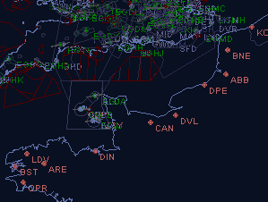
Coastlines |
|
|
The default coastline provided in BaseStation is of low detail but provides a world-wide coastline in a reasonably small data file (the General.out file of approx. 3Mb). These replacement sets are provided for users who do not need a full world-wide coastline but would prefer a regional coast of a much higher degree of detail. Any number of coastline files can be installed but for most systems it is recommended that a maximum of two should be active at any time. Coastline
data files are large so may not be usable on low end PC's. 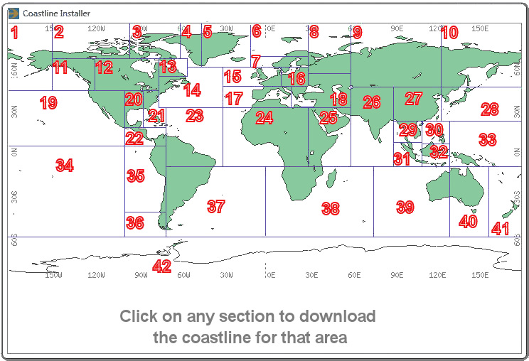
|
|
|
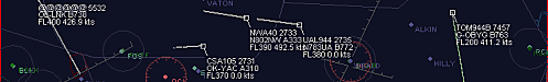
Airspace |
|
|
Outline files for UK airspace correct to the UK 5 May 2011 AIRAC data. Outlines include:
|
|
|
Ireland Airspace Outline files for Irish airspace correct to the Ireland Nov 2010 AIRAC data. Outlines include:
|
|
|
Airfield Plans |
|
|
Civil Airfield Plans These outlines are high resolution but show paved detail only. They display runway, taxiway and apron edges but not runway/taxiway/apron markings, airfield buildings or structures as these can frequently change. Note: An alternative set of extremely high detail airfield files are available on the SBS-Resources CD or from the Kinetic Downloads page. The airfield plans cover the following 142 UK and 13 Irish airfields: Aberdeen, Andreas, Andrewsfield, Barra, Barrow, Barton, Beccles, Belfast Aldergrove, Belfast City, Bembridge, Benbecula, Beverley, Biggin Hill, Birmingham, Blackbushe, Blackpool, Bodmin, Bourn, Bournemouth, Bristol, Caernarfon, Cambridge, Campbeltown, Cardiff, Carlisle, Chalgrove, Chichester, Clacton, Coll, Compton Abbas, Coventry, Cranfield, Cumbernauld, Damyn's Hall, Denham, Derby, Doncaster Robin Hood, Dundee, Dunkeswell, Durham Tees, Duxford, Eaglescott, Earl's Colne, Eday, Edinburgh, Elstree, Enniskillen, Exeter, Fairoaks, Farnborough, Fenland, Fife, Filton, Full Sutton, Glasgow, Gloucester, Guernsey, Haverford, Hawarden, Hucknall, Humberside, Inverness, Islay, Isle of Man, Jersey, Jurby, Kemble, Kirkwall, Land's End, Langford Lodge, Lashenden, Leeds, Leicester, Lerwick, Liverpool, London City, London Heathrow, London Gatwick, London Stansted, London Luton, Londonderry, Lydd, Manchester, Manchester Woodford, Manston, Netherthorpe, Newcastle, Newquay, Newtownards, Northampton, Norwich, Nottingham East Midlands, Nottingham Tollerton, Oban,Old Buckenham, Old Sarum, Old Warden, Oxford, Panshangar, Papa Westray, Pembrey, Perranporth, Perth, Peterborough Conington, Peterborough Sibson, Plymouth, Prestwick, Redhill, Retford, Rochester, Sanday, Sandown, Sandtoft, Scatsta, Scilly Isles, Seething, Sherburn, Shobdon, Shoreham, Sleap, Southampton, Southend, Stapleford, Stornoway, Stronsay, Sumburgh, Swansea, Tatenhill, Thruxton, Truro, Turweston, Warton, Wellesbourne, Welshpool, West Wales, Westray, White Waltham, Wick, Wickenby, Wolverhampton, Wycombe, Yeovil. Baldonnel, Cork, Dublin, Galway, Inisheer, Inishmann, Inishmore, Inveran, Ireland West, Kerry, Shannon, Sligo, Waterford. Author: Bones Latest update - 7 Apr 2011 (adds airfields at Coll, Cumbernauld, Eday, Enniskillen, Fife, Guernsey and Islay.)
|
|
|
Other |
|
|
European VOR Roses VOR roses for European navaids that are the next en route point for airways exiting UK airspace. Also included is a waypoint file for users who do not have any European navaid data loaded. The
VOR roses are enabled by turning on Layer 15 in the Outlines section
of the Display Settings. Latest update - 28 Dec 2010 |
 |